 English
 Deutsch
 Italia
 August 27, 2026 By admin
Great Rivers Rising in Tibet
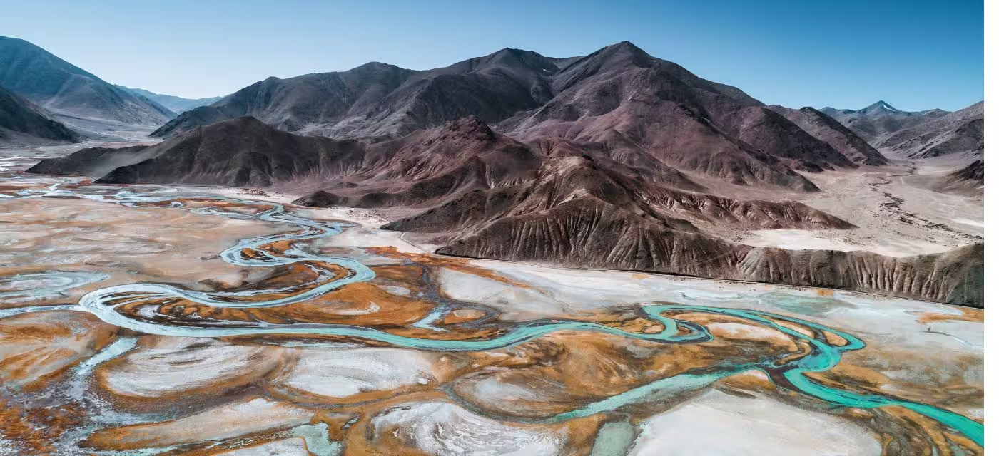
TOP 5 GREAT RIVERS RISING IN TIBET
Rivers gushing through deep canyons at the edges of the Tibetan Plateau hold the highest hydropower potential in the world. The headwaters of seven major rivers are in Tibet: they flow into the world’s largest deltas and spread in an arc across Asia. Tibet represents the largest body of ice and permafrost outside the Arctic and Antarctic regions. The Tibetan Plateau is home to the Himalayas, the world’s tallest mountain range. Meltwater from Tibet’s glaciers and snowfall, and the rivers arising in Tibet, provide 40% of the earth’s population with fresh water.
Rivers support entire ecosystems. They carry tons of nutrient-rich silt downstream, a cocktail of elements needed for growing plants: nitrogen, phosphorus, potassium, magnesium, and calcium. Silt is essential for agriculture and for bolstering the deltas against rising sea levels.
Scientists say the Himalayas also influence weather patterns, which help to predict rainfall and flood cycles. Two of the continent’s wildest rivers have their sources in Tibet: the Salween and the Brahmaputra.
Presenting some of Tibet’s most important rivers.
SALWEEN (OR NU)
Around 2,815 kilometres long, the River Salween originates from the River Nagqu in the Tanggula Mountains of Tibet. It flows from the Tibetan Plateau adjacent to the Mekong and the Yangtze, in the ‘Three Parallel Rivers’ UNESCO World Heritage area, at the epicentre of biodiversity in China; from there through Myanmar and Thailand and finally into the Andaman Sea in Southeast Asia.
The Salween River basin is the second-largest river basin in Southeast Asia. Swift, powerful, and undammed, it is one of the longest and last free-flowing international rivers in Asia. The Salween is the lifeline of over six million people who live in the Salween watershed and depend on the river for their livelihood.
The Salween delta and associated wetlands support populations of the unique Fishing Cat, the Asian Small-clawed Otter, and the Siamese Crocodile. It has the world’s greatest diversity of turtles, including the Giant Asian Pond Terrapin and Bigheaded Turtle. Highly endangered wildlife species such as the Golden Eye Monkey, Small Panda, Wild Donkey of Dulong, and Wild Ox still flourish in this basin. The Salween is also known as the ‘Grand Canyon of the East’ because of the spectacular scenery it offers along its course.
MEKONG (OR LANCANG)
From China to Vietnam, the River Mekong is the lifeline of Southeast Asia and offers glimpses into the region’s ancient history and diverse cultures. The river is a major trade route between China and Southeast Asia. About 60 million people depend on the Lancang River for their livelihood. The Mekong is truly a unifier, as it is home to ethnic groups from six different countries – there are as many as 100 ethnic groups living along the lower basin alone.
At 4,350 km, it is the 12th-longest river in the world and the seventh-longest in Asia, and flows through six countries: China, Myanmar, Thailand, Laos, Cambodia, and Vietnam. The river’s headwaters originate on the Tibetan Plateau and it flows down to the mountainous area through China’s Yunnan Province in the Hengduan Mountains. As home to thousands of fish, plant, bird, reptile, and mammal species, the Mekong is one of the most biologically diverse areas in the world.
YARLUNG TSANGPO
Explorers call Tibet’s Yarlung Tsangpo the “Everest of Rivers” because it is extremely dangerous and nearly impossible to navigate its entire length. The Yarlung Tsangpo has the highest average elevation – 4,000 metres (13,000 feet) – of any major river in the world. It is also the longest river in Tibet, stretching for about 2,900 km and running through eastern Tibet.
With headwaters originating at Angsi Glacier in western Tibet, southeast of Mount Kailash and Lake Manasarovar, it later forms the South Tibet Valley and Yarlung Tsangpo Grand Canyon before passing into the state of Arunachal Pradesh, India. Downstream from Arunachal Pradesh, the river becomes phenomenally wider and is called the Siang. After reaching Assam, the river is known as the Brahmaputra.
The Brahmaputra River Grand Canyon or Yarlung Tsangpo Grand Canyon is defined by superlatives. Carved into granitic bedrock, it falls over 5,300 metres (17,000 feet) from top to bottom in some places, making it the deepest canyon in the world – thrice as deep as the Grand Canyon. It is also one of the world’s longest canyons, stretching over 500 kilometres (300 miles).
INDUS
One of the longest rivers in Asia (3,610 km), the River Indus originates in the vicinity of Mount Kailash and Lake Manasarovar on the Tibetan Plateau and runs its course through China, India, and Pakistan – it is the longest river and national river of Pakistan – before merging with the Arabian Sea.
Beginning in a mountain spring and fed by glaciers and rivers in the Himalayas, the river supports ecosystems of temperate forests, plains, and arid countryside.
The major cities – Harappa and Mohenjo-daro – of the Indus Valley Civilisation, one of three early cradles of civilisations of the Old World, grew and flourished along the Indus. The Indus region is home to diverse ethnic groups, religions, cultures, and languages, creating a spectacular border heritage of society and traditions dating back thousands of years.
The river has been the backbone of water, food production, agriculture, and the economy for Pakistan and Punjab, India.
The Indus Valley trek in Ladakh is an exhilarating experience, revealing snow-capped mountains on one side and, on the other, the River Indus in all its glory.
YELLOW RIVER
The Yellow River (or Ma Chu in Tibet) originates in Qinghai Province on the Tibetan Plateau and flows through China. Called the ‘Cradle of Chinese Civilisation’ and also the “mother river of China”, the Yellow River’s basin was the centre of Chinese politics, economy, and culture for over 2,000 years, making it the most prosperous region in early Chinese history.
Stretching to a length of 5,464 km, the Yellow River is the second-longest river in Asia and the sixth-longest river system in the world. The name ‘Yellow River’ comes from the huge amounts of ‘yellow’ loess sediment it carries when flowing through the Loess Plateau – it is the world’s muddiest major river.
The Yellow River is the site of numerous historic and ancient attractions, as well as stunning scenery. Top attractions include forest parks, deserts, grasslands, the Loess Plateau, ancient capitals, the Silk Road, and a “chocolate” waterfall. The Hukou Waterfall is the classic Yellow River attraction.
Related Posts